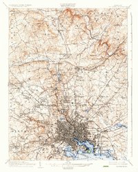
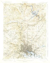
1904 Map of Baltimore
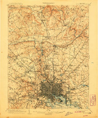
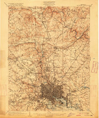
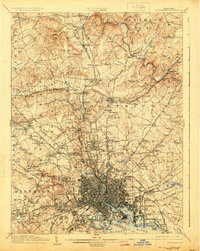
USGS Topo · Published 1936About this map
Baltimore City and its surrounding districts show a complex transition from dense urban grids to rural turnpikes and river valleys in this 1902 survey. The industrial and maritime heart of the region is centered on the Patapsco River and the North West Harbor, guarded by the grounds of Fort McHenry National Park and the landmark Lazaretto Pt. This era captures the city's growth along established corridors like the York Turnpike and Reisterstown Turnpike, which linked downtown to burgeoning northern suburbs such as Mount Washington and Lutherville.
Find a feature on this map
194 named features on this map. Tap any name to fly to it.
Don’t see what you’re looking for? This feature index may not catch every label — zoom into the map to look around manually.
Map Details
Editions of this 1904 Baltimore Map
8 editions found


Other maps of this area

1892 · Laurel
USGS Topo · 1:62,500

1892 · Ellicott
USGS Topo · 1:62,500

1893 · North Point
USGS Topo · 1:62,500

1893 · Gunpowder
USGS Topo · 1:62,500

1894 · Ellicott
USGS Topo · 1:62,500

1894 · Laurel
USGS Topo · 1:62,500

1894 · Baltimore
USGS Topo · 1:62,500

1894 · Relay
USGS Topo · 1:62,500

1897 · Laurel
USGS Topo · 1:62,500

1898 · Tolchester
USGS Topo · 1:125,000