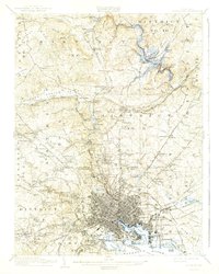
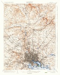
1904 Map of Baltimore
USGS Topo · Published 1942About this map
Fort McHenry National Mon stands guard over the North West Harbor, anchoring a landscape where Maryland's industrial and residential growth radiate from the harbor's edge. This early 20th-century view reveals the city's intricate rail network, featuring the Northern Central RR and Maryland and Pennsylvania RR snaking through valleys and urban corridors. The map records the development of planned communities like Roland Park and Tuxedo Park, juxtaposed against established industrial sites such as Ashland Furnace and the lime-quarrying area near Texas.
Find a feature on this map
216 named features on this map. Tap any name to fly to it.
Don’t see what you’re looking for? This feature index may not catch every label — zoom into the map to look around manually.
Map Details
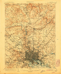
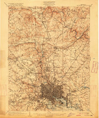
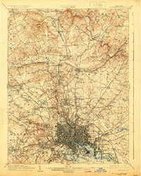
Editions of this 1904 Baltimore Map
8 editions found


Other maps of this area

1892 · Laurel
USGS Topo · 1:62,500

1892 · Ellicott
USGS Topo · 1:62,500

1893 · North Point
USGS Topo · 1:62,500

1893 · Gunpowder
USGS Topo · 1:62,500

1894 · Ellicott
USGS Topo · 1:62,500

1894 · Laurel
USGS Topo · 1:62,500

1894 · Baltimore
USGS Topo · 1:62,500

1894 · Relay
USGS Topo · 1:62,500

1897 · Laurel
USGS Topo · 1:62,500

1898 · Tolchester
USGS Topo · 1:125,000