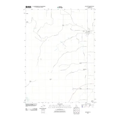
2010 Map of Bancroft
USGS Topo · Published 2010About this map
Bancroft serves as the primary hub in this southeastern Idaho landscape, situated where the grid of Old Hwy 30 and the railroad-influenced corridors meet. The terrain is defined by a series of significant canyons including Smith Canyon and North Canyon to the north, giving way to the high elevations of Petticoat Peak and Buckskin Mountain. Water resources appear vital to the agricultural and ranching history of the region, evidenced by numerous named springs such as Milkshake Spring, Railroad Spring, and the curiously named School House Spring.
Find a feature on this map
38 named features on this map. Tap any name to fly to it.
Don’t see what you’re looking for? This feature index may not catch every label — zoom into the map to look around manually.
Map Details
Editions of this 2010 Bancroft Map
This is the sole edition of this map. No revisions or reprints were ever made.
Other maps of this area

1917 · Portneuf
USGS Topo · 1:62,500

1948 · Bancroft
USGS Topo · 1:62,500

1949 · Bancroft
USGS Topo · 1:62,500

1954 · Pocatello
USGS Topo · 1:250,000

1955 · Preston
USGS Topo · 1:250,000

1958 · Pocatello
USGS Topo · 1:250,000

1958 · Preston
USGS Topo · 1:250,000

1962 · Preston
USGS Topo · 1:250,000

1968 · Bear Camp Gulch
USGS Topo · 1:24,000

1968 · Lava Hot Springs
USGS Topo · 1:24,000