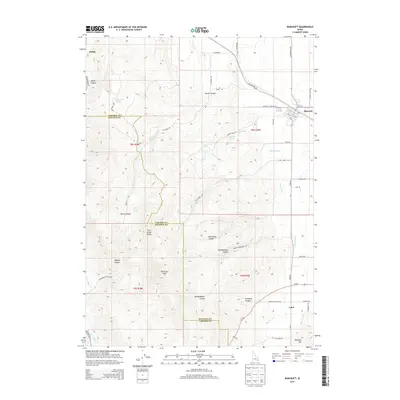
2013 Map of Bancroft
USGS Topo · Published 2013About this map
The town of Bancroft sits at the high-desert intersection of commerce and agriculture in Caribou County, where the grid of Old Highway 30 meets the local road network. The landscape transitions sharply from the irrigation-dependent plains of the West Br Canal to the steep elevations of the Fish Creek Range and the Petticoat Peak summit. These highlands are cut by numerous draws, including Hadley Canyon, Red House Canyon, and Lundgren Canyon, which historically provided natural corridors through the varied terrain.
Find a feature on this map
58 named features on this map. Tap any name to fly to it.
Don’t see what you’re looking for? This feature index may not catch every label — zoom into the map to look around manually.
Map Details
Editions of this 2013 Bancroft Map
This is the sole edition of this map. No revisions or reprints were ever made.
Other maps of this area

1917 · Portneuf
USGS Topo · 1:62,500

1948 · Bancroft
USGS Topo · 1:62,500

1949 · Bancroft
USGS Topo · 1:62,500

1954 · Pocatello
USGS Topo · 1:250,000

1955 · Preston
USGS Topo · 1:250,000

1958 · Pocatello
USGS Topo · 1:250,000

1958 · Preston
USGS Topo · 1:250,000

1962 · Preston
USGS Topo · 1:250,000

1968 · Bear Camp Gulch
USGS Topo · 1:24,000

1968 · Lava Hot Springs
USGS Topo · 1:24,000