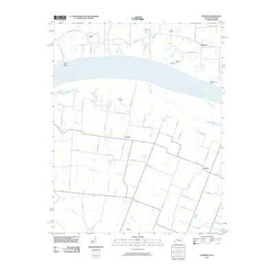
2010 Map of Bandana
USGS Topo · Published 2010About this map
The Ohio River dominates this landscape along the border of Illinois and Kentucky, where the river's wide course defines the local geography. On the northern bank, the settlement of Hillerman and the Grand Chain Landing highlight a historical connection to river transport and navigation. Inland, the terrain is marked by numerous family and community burial grounds, including Ohio Chapel Cemetery, Miles Cemetery, and Hitchcock Cemetery, which serve as vital touchstones for genealogical research in the region.
Find a feature on this map
63 named features on this map. Tap any name to fly to it.
Don’t see what you’re looking for? This feature index may not catch every label — zoom into the map to look around manually.
Map Details
Editions of this 2010 Bandana Map
This is the sole edition of this map. No revisions or reprints were ever made.
Other maps of this area

1918 · Vienna
USGS Topo · 1:62,500

1919 · Vienna
USGS Topo · 1:62,500

1920 · Dongola
USGS Topo · 1:62,500

1923 · Dongola
USGS Topo · 1:62,500

1928 · La Center
USGS Topo · 1:62,500

1931 · Cairo
USGS Topo · 1:62,500

1932 · La Center
USGS Topo · 1:62,500

1933 · Cairo
USGS Topo · 1:62,500

1939 · Cairo
USGS Topo · 1:62,500

1942 · Vienna
USGS Topo · 1:62,500