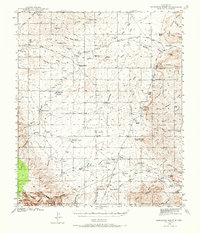
1940 Map of Bandanna Point
USGS Topo · Published 1973About this map
The high plateau and canyon country of Eddy County are revealed in this 1940 survey, a landscape defined by an extensive network of cattle ranches and isolated water sources. Family-run operations like Tatman Ranch, Cawley Ranch, and Mendoza Ranch are scattered across the terrain, connected by primitive tracks such as the Panama Cawley Road. The importance of water management in this arid environment is evident from the numerous man-made features like CCC Tank, Loafer Tank, and Raider Well. To the south, the terrain descends into the deep cuts of Last Chance Canyon and Anderson Canyon as it enters the Lincoln National Forest. Notable landmarks like the prominent Bandanna Point and the wide expanse of Bogle Flats provide a clear sense of the topography before later development or modernization of the ranching infrastructure.
Find a feature on this map
74 named features on this map. Tap any name to fly to it.
Don’t see what you’re looking for? This feature index may not catch every label — zoom into the map to look around manually.
Map Details
Editions of this 1940 Bandanna Point Map
Other maps of this area

1935 · El Paso Gap
USGS Topo · 1:62,500

1936 · El Paso Gap
USGS Topo · 1:48,000

1940 · El Paso Gap
USGS Topo · 1:62,500

1940 · Bandanna Point
USGS Topo · 1:62,500

1940 · Carlsbad Caverns West
USGS Topo · 1:62,500

1943 · Carlsbad Caverns West
USGS Topo · 1:62,500

1943 · Bandanna Point
USGS Topo · 1:62,500

1943 · Texas Hill
USGS Topo · 1:62,500

1943 · West Carlsbad
USGS Topo · 1:62,500

1945 · Texas Hill
USGS Topo · 1:62,500