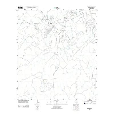
2013 Map of Bandera
USGS Topo · Published 2013About this map
Bandera sits at the heart of this Texas Hill Country landscape, oriented along the winding path of the Medina River. The town's grid is bounded by a mix of established routes like Old San Antonio Rd and Ranch Road 470, reflecting its long-standing role as a regional hub. Beyond the town center, the terrain is defined by dramatic limestone features and intermittent waterways including San Julian Cr and Bruins Cr.
Find a feature on this map
134 named features on this map. Tap any name to fly to it.
Don’t see what you’re looking for? This feature index may not catch every label — zoom into the map to look around manually.
Map Details
Editions of this 2013 Bandera Map
This is the sole edition of this map. No revisions or reprints were ever made.
Other maps of this area

1954 · San Antonio
USGS Topo · 1:250,000

1956 · Comfort
USGS Topo · 1:62,500

1956 · Bandera
USGS Topo · 1:62,500

1956 · Medina Lake
USGS Topo · 1:62,500

1956 · Center Point
USGS Topo · 1:62,500

1957 · San Antonio
USGS Topo · 1:250,000

1964 · Bandera
USGS Topo · 1:24,000

1964 · Timber Creek
USGS Topo · 1:24,000

1964 · Rock Cliff Reservoir
USGS Topo · 1:24,000

1964 · Medina Lake
USGS Topo · 1:24,000