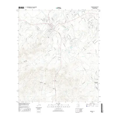
2016 Map of Bandera
USGS Topo · Published 2016About this map
The Medina River meanders through the heart of the Texas Hill Country, anchoring the historic settlement of Bandera. This landscape is defined by its dramatic topographic relief, where the river valley is hemmed in by prominent heights like Town Mtn and Rugh Hill. The local hydrography is particularly diverse, featuring a network of named springs and small lakes, such as Dripping Springs, Kindla Spring, and the multi-part Alkek Lake Number 1. To the south, the terrain levels out into the Potato Flats and the hollows near Gate Hollow, showing the complex drainage patterns of San Julian Cr and Bruins Cr. Modern infrastructure like the Lobo Mountain Ranch Airport and the development of Lake Medina Shores indicates the evolution of the area from a purely ranching and river-focused economy to one increasingly integrated with recreation and private aviation. The street grid of the town center, including Main St and 11th St, provides a clear view of the community's layout along the river bend.
Find a feature on this map
131 named features on this map. Tap any name to fly to it.
Don’t see what you’re looking for? This feature index may not catch every label — zoom into the map to look around manually.
Map Details
Editions of this 2016 Bandera Map
This is the sole edition of this map. No revisions or reprints were ever made.
Other maps of this area

1954 · San Antonio
USGS Topo · 1:250,000

1956 · Comfort
USGS Topo · 1:62,500

1956 · Bandera
USGS Topo · 1:62,500

1956 · Medina Lake
USGS Topo · 1:62,500

1956 · Center Point
USGS Topo · 1:62,500

1957 · San Antonio
USGS Topo · 1:250,000

1964 · Bandera
USGS Topo · 1:24,000

1964 · Timber Creek
USGS Topo · 1:24,000

1964 · Rock Cliff Reservoir
USGS Topo · 1:24,000

1964 · Medina Lake
USGS Topo · 1:24,000