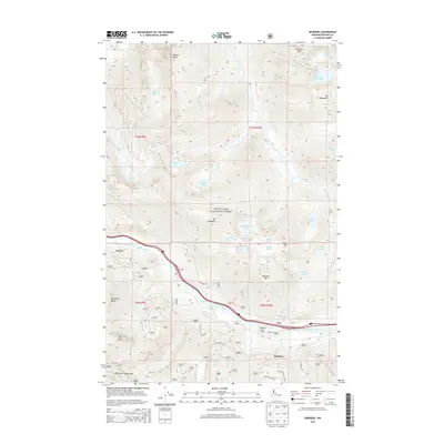
2014 Map of Bandera
USGS Topo · Published 2014About this map
The South Fork Snoqualmie River carves a deep corridor through this high-altitude landscape of the Snoqualmie National Forest, providing a vital transit route for both interstate traffic and the river itself. This 2014 survey captures the high-country terrain where technical peaks like Mt Defiance and McClellan Butte tower over a high concentration of mountain lakes. To the south, the protected Cedar River Watershed borders the settlement of Bandera, which sits near the Bandera State Airport. The area's character is defined by its recreation and conservation value, with numerous hiking and backcountry destinations such as Mason Lake, Island Lake, and Pratt Lake dotting the alpine basins. The map also traces the winding course of the westernmost rail and road grades near the small settlement of Garcia, illustrating how human infrastructure is funneled through the narrow valley floor between massive peaks like Bandera Mtn.
Find a feature on this map
63 named features on this map. Tap any name to fly to it.
Don’t see what you’re looking for? This feature index may not catch every label — zoom into the map to look around manually.
Map Details
Editions of this 2014 Bandera Map
This is the sole edition of this map. No revisions or reprints were ever made.
Other maps of this area

1901 · Snoqualmie Pass
USGS Topo · 1:125,000

1902 · Skykomish
USGS Topo · 1:125,000

1903 · Snoqualmie
USGS Topo · 1:125,000

1905 · Skykomish
USGS Topo · 1:125,000

1913 · Cedar Lake
USGS Topo · 1:125,000

1921 · Sultan
USGS Topo · 1:125,000

1923 · Sultan
USGS Topo · 1:125,000

1957 · Wenatchee
USGS Topo · 1:250,000

1960 · Mount Si
USGS Topo · 1:62,500

1960 · Bandera
USGS Topo · 1:62,500