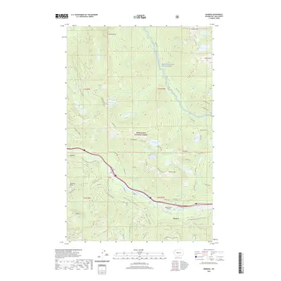
2020 Map of Bandera
USGS Topo · Published 2020About this map
Bandera Mountain and Mt Defiance anchor this high-elevation landscape within the Snoqualmie National Forest, where steep ridgelines separate numerous alpine basins. The topography is defined by its glacial hydrology, featuring a high density of named water bodies such as Lake Kulla Kulla, Mason Lake, and the Pratt River, which is designated here as the Pratt Wild and Scenic River. The transportation corridor in the southern half of the map follows the South Fork Snoqualmie River, where Interstate 90 runs parallel to the Palouse To Cascades State Park Trail. This trail reflects the conversion of former rail infrastructure into recreational space, passing the small settlements of Bandera and Garcia. Near the river, the Bandera State Airport serves as a notable landmark amidst the peaks of McClellan Butte and Mt Kent.
Find a feature on this map
59 named features on this map. Tap any name to fly to it.
Don’t see what you’re looking for? This feature index may not catch every label — zoom into the map to look around manually.
Map Details
Editions of this 2020 Bandera Map
This is the sole edition of this map. No revisions or reprints were ever made.
Other maps of this area

1901 · Snoqualmie Pass
USGS Topo · 1:125,000

1902 · Skykomish
USGS Topo · 1:125,000

1903 · Snoqualmie
USGS Topo · 1:125,000

1905 · Skykomish
USGS Topo · 1:125,000

1913 · Cedar Lake
USGS Topo · 1:125,000

1921 · Sultan
USGS Topo · 1:125,000

1923 · Sultan
USGS Topo · 1:125,000

1957 · Wenatchee
USGS Topo · 1:250,000

1960 · Mount Si
USGS Topo · 1:62,500

1960 · Bandera
USGS Topo · 1:62,500