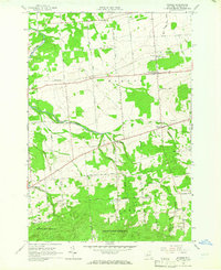
1964 Map of Bangor
USGS Topo · Published 1966About this map
The Little Salmon River meanders across this northern New York landscape, anchoring a rural network of hamlets and family-owned farm plots in the mid-1960s. Small population centers like North Bangor, West Bangor, and Skerry are connected by a dense grid of named roads such as Taylor Road and La Flesh Road, reflecting a century of agricultural development in Franklin County. To the south, the topography rises significantly into the timbered slopes of Franklin State Forest No 1, where the forest service maintains a Radio Tower and elevations increase away from the river valley.
Find a feature on this map
62 named features on this map. Tap any name to fly to it.
Don’t see what you’re looking for? This feature index may not catch every label — zoom into the map to look around manually.
Map Details
Editions of this 1964 Bangor Map
2 editions found
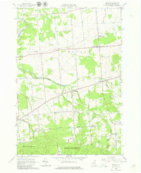
Other maps of this area

1915 · Malone
USGS Topo · 1:62,500

1915 · Moira
USGS Topo · 1:62,500

1917 · Malone
USGS Topo · 1:62,500

1917 · Moira
USGS Topo · 1:62,500

1919 · Nicholville
USGS Topo · 1:62,500

1921 · Nicholville
USGS Topo · 1:62,500

1921 · Santa Clara
USGS Topo · 1:62,500

1923 · Santa Clara
USGS Topo · 1:62,500

1944 · Moira
USGS Topo · 1:62,500

1948 · Ogdensburg
USGS Topo · 1:250,000