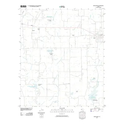
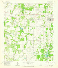
2010 Map of Bangs West
USGS Topo · Published 2010About this map
Bangs serves as the primary population center on this landscape in Brown County, where the plains of Central Texas meet the energy resources of the Santa Anna Gas and Oil Field. The 2010 survey reveals a rural infrastructure heavily influenced by water management and petroleum extraction. A network of reservoirs, including Soil Conservation Service Site 7 Reservoir and Soil Conservation Service Site 9 Reservoir, underscores the regional commitment to soil conservation and flood control along the tributaries of Mukewater Creek. Small settlements like Liberty, Obregon, and Concord are connected by an extensive system of county roads, while the Janellen Gas Field indicates the ongoing industrial presence in the south. Genealogists may find value in the location of the Mukewater Cemetery, which remains a quiet landmark north of the East Fork Mukewater Creek.
Find a feature on this map
55 named features on this map. Tap any name to fly to it.
Don’t see what you’re looking for? This feature index may not catch every label — zoom into the map to look around manually.
Map Details
Editions of this 2010 Bangs West Map
This is the sole edition of this map. No revisions or reprints were ever made.
Other maps of this area

1887 · Coleman
USGS Topo · 1:125,000

1889 · Coleman
USGS Topo · 1:125,000

1924 · Brownwood Reservoir Site
USGS Topo · 1:48,000

1927 · Grosvenor
USGS Topo · 1:62,500

1954 · Brownwood
USGS Topo · 1:250,000
1962 · Speck Mountain
USGS Topo · 1:24,000
1962 · Trickham
USGS Topo · 1:24,000
1962 · Bangs East
USGS Topo · 1:24,000

1962 · Santa Anna
USGS Topo · 1:24,000
1962 · Bangs West
USGS Topo · 1:24,000