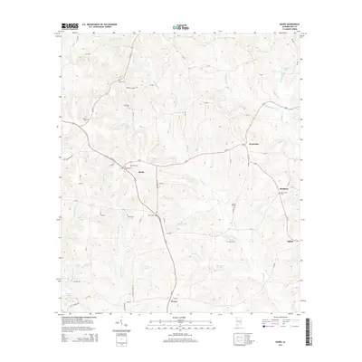
2014 Map of Banks
USGS Topo · Published 2014About this map
The town of Banks sits at the junction of Us-29 and Al-93, serving as a central hub for this rural stretch of Pike County. The landscape is defined by the branching waterways of Richland Cr and Whitewater Cr, which create a complex drainage pattern across the terrain. Numerous family and community landmarks are documented here, including Hussey Cem, Wilson Cem, and the Brooks Graves site, offering significant detail for genealogical research. Smaller settlements and neighborhoods like Monticello, Buckhorn, and Pronto are connected by a network of county roads such as Butter and Egg Rd. The presence of several ponds, such as Foy Ingram Pond and Wilsons Pond, highlights the importance of local water management in this agricultural region. This survey provides a clear view of the area's infrastructure before major modern shifts, capturing the placement of rural churches and remote cemeteries that define the local heritage.
Find a feature on this map
68 named features on this map. Tap any name to fly to it.
Don’t see what you’re looking for? This feature index may not catch every label — zoom into the map to look around manually.
Map Details
Editions of this 2014 Banks Map
This is the sole edition of this map. No revisions or reprints were ever made.
Other maps of this area

1948 · Brundidge
USGS Topo · 1:62,500

1950 · Brundidge
USGS Topo · 1:62,500

1953 · Dothan
USGS Topo · 1:250,000

1954 · Dothan
USGS Topo · 1:250,000

1955 · Dothan
USGS Topo · 1:250,000

1960 · Brundidge
USGS Topo · 1:24,000

1960 · Brundidge NW
USGS Topo · 1:24,000

1962 · Brundidge
USGS Topo · 1:25,000
1962 · Brundidge NW
USGS Topo · 1:25,000

1968 · Perote
USGS Topo · 1:24,000