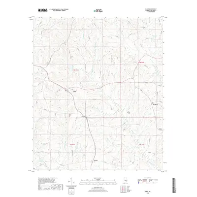
2018 Map of Banks
USGS Topo · Published 2018About this map
Richland Creek and its many tributaries, including Buckhorn Creek and Beaver Branch, carve a complex drainage pattern across this section of Pike County. The landscape is dotted with small rural communities and crossroad settlements such as Banks, Buckhorn, and Pronto, each serving as a focal point for the surrounding agricultural lands. For those researching local families, the map is remarkably detailed in its documentation of burial sites, identifying numerous small cemeteries like Antioch Cemetery, Hussey Cemetery, and Cotton Cemetery. The inclusion of Brooks Graves suggests a more intimate, perhaps private family site, while the Old Dothan Cemetery points toward older congregational roots in the area. This network of rural roads and water features, such as Richardsons Pond and Wilsons Pond, illustrates the persistent rural character of the Alabama coastal plain in the early 21st century.
Find a feature on this map
85 named features on this map. Tap any name to fly to it.
Don’t see what you’re looking for? This feature index may not catch every label — zoom into the map to look around manually.
Map Details
Editions of this 2018 Banks Map
This is the sole edition of this map. No revisions or reprints were ever made.
Other maps of this area

1948 · Brundidge
USGS Topo · 1:62,500

1950 · Brundidge
USGS Topo · 1:62,500

1953 · Dothan
USGS Topo · 1:250,000

1954 · Dothan
USGS Topo · 1:250,000

1955 · Dothan
USGS Topo · 1:250,000

1960 · Brundidge
USGS Topo · 1:24,000

1960 · Brundidge NW
USGS Topo · 1:24,000

1962 · Brundidge
USGS Topo · 1:25,000
1962 · Brundidge NW
USGS Topo · 1:25,000

1968 · Perote
USGS Topo · 1:24,000