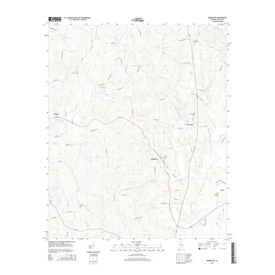
2014 Map of Bankston
USGS Topo · Published 2014About this map
Bankston and the surrounding Fayette County landscape are defined by a dense network of creek valleys and ridges where rural communities have persisted for generations. In the early 21st century, the area remains anchored by its local landmarks, including several family and community burial grounds such as Zion Cem and Philadelphia Cem. The hydrology of the region is centered on the North River and its numerous tributaries, including Deadwater Cr and Clear Cr. This terrain is navigated by a web of county roads like Heartline Rd and Old Liberty Rd, which connect the small clusters of Cleveland and Stough to the larger surrounding area. The presence of Fayette County Lake and Bays Lake suggests a landscape where water management and recreation are central to local geography alongside the established settlement patterns of the Alabama interior.
Find a feature on this map
82 named features on this map. Tap any name to fly to it.
Don’t see what you’re looking for? This feature index may not catch every label — zoom into the map to look around manually.
Map Details
Editions of this 2014 Bankston Map
This is the sole edition of this map. No revisions or reprints were ever made.
Other maps of this area

1953 · Birmingham
USGS Topo · 1:250,000

1956 · Birmingham
USGS Topo · 1:250,000

1957 · Birmingham
USGS Topo · 1:250,000

1967 · Bankston
USGS Topo · 1:24,000

1967 · Winfield SE
USGS Topo · 1:24,000

1967 · Newtonville
USGS Topo · 1:24,000

1967 · Hubbertville
USGS Topo · 1:24,000
1967 · Berry
USGS Topo · 1:24,000

1967 · Fayette
USGS Topo · 1:24,000
1967 · New Lexington
USGS Topo · 1:24,000