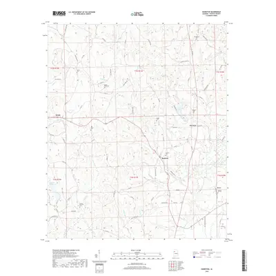
2018 Map of Bankston
USGS Topo · Published 2018About this map
The North River and its numerous tributaries, including Boxes Cr and Deadwater Cr, define the landscape of eastern Fayette County. This topographic record documents a rural Alabama community structured by family-named roads and localized landmarks. Smaller settlements like Bankston and Cleveland are interconnected by a network of county roads, such as Co RD 93 and Cleveland Rd, illustrating the persistence of historical township patterns. The abundance of small burial grounds, including the Bankston Cem, Oak Grove Cem, and Phillips Memorial Cem, provides significant genealogical touchpoints for local families. The landscape is also punctuated by water features like Bugs Lake and the western edge of Berry, alongside larger bodies such as Fayette County Lake, which emphasize the region's reliance on its natural drainage systems.
Find a feature on this map
84 named features on this map. Tap any name to fly to it.
Don’t see what you’re looking for? This feature index may not catch every label — zoom into the map to look around manually.
Map Details
Editions of this 2018 Bankston Map
This is the sole edition of this map. No revisions or reprints were ever made.
Other maps of this area

1953 · Birmingham
USGS Topo · 1:250,000

1956 · Birmingham
USGS Topo · 1:250,000

1957 · Birmingham
USGS Topo · 1:250,000

1967 · Bankston
USGS Topo · 1:24,000

1967 · Winfield SE
USGS Topo · 1:24,000

1967 · Newtonville
USGS Topo · 1:24,000

1967 · Hubbertville
USGS Topo · 1:24,000
1967 · Berry
USGS Topo · 1:24,000

1967 · Fayette
USGS Topo · 1:24,000
1967 · New Lexington
USGS Topo · 1:24,000