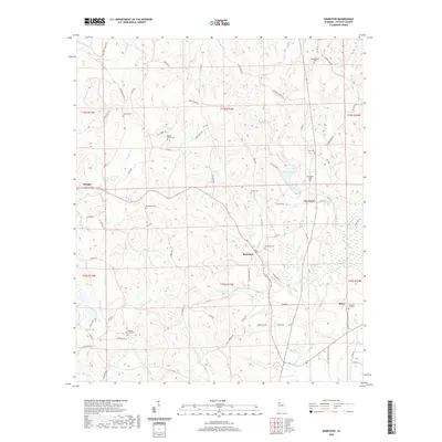
2020 Map of Bankston
USGS Topo · Published 2020About this map
Bankston and the neighboring community of Cleveland anchor this rural Fayette County landscape, where the terrain is deeply dissected by a dense network of watercourses including Baker Cr, Deadwater Cr, and Little Piney Cr. The map reveals a settlement pattern characterized by numerous small, family and community burial grounds, such as Philadelphia Cem and Oak Grove Cem, which reflect the long-standing genealogical roots of this Alabama region. The North River meanders through the southern portion of the quadrangle, joined by tributaries like Sandy Point Cr and Piney Knot Cr. The local road network, including Fords Valley Rd and Lowery Rd, weaves around the complex topography, connecting dispersed homesteads and landmarks like Bugs Lake and the settlement of Stough in the west.
Find a feature on this map
87 named features on this map. Tap any name to fly to it.
Don’t see what you’re looking for? This feature index may not catch every label — zoom into the map to look around manually.
Map Details
Editions of this 2020 Bankston Map
This is the sole edition of this map. No revisions or reprints were ever made.
Other maps of this area

1953 · Birmingham
USGS Topo · 1:250,000

1956 · Birmingham
USGS Topo · 1:250,000

1957 · Birmingham
USGS Topo · 1:250,000

1967 · Bankston
USGS Topo · 1:24,000

1967 · Winfield SE
USGS Topo · 1:24,000

1967 · Newtonville
USGS Topo · 1:24,000

1967 · Hubbertville
USGS Topo · 1:24,000
1967 · Berry
USGS Topo · 1:24,000

1967 · Fayette
USGS Topo · 1:24,000
1967 · New Lexington
USGS Topo · 1:24,000