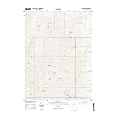
2013 Map of Bannock Peak
USGS Topo · Published 2013About this map
Bannock Peak and White Quartz Mtn anchor this high-elevation landscape in Power County, where the southern reaches of the Fort Hall Indian Reservation meet a complex network of canyons and plateaus. The drainage patterns define the local geography, with W Fork Bannock Cr and E Fork Rock Cr carving deep into the terrain. High-altitude points of interest include Jim Brown Pass and Moonshine Peak, while the western edge is defined by broad plateaus such as Howard Flat and Warner Flat.
Find a feature on this map
48 named features on this map. Tap any name to fly to it.
Don’t see what you’re looking for? This feature index may not catch every label — zoom into the map to look around manually.
Map Details
Editions of this 2013 Bannock Peak Map
This is the sole edition of this map. No revisions or reprints were ever made.
Other maps of this area

1934 · Rockland
USGS Topo · 1:62,500

1937 · Rockland
USGS Topo · 1:62,500

1938 · Pauline
USGS Topo · 1:48,000

1944 · Arbon
USGS Topo · 1:62,500

1954 · Pocatello
USGS Topo · 1:250,000

1958 · Pocatello
USGS Topo · 1:250,000

1971 · Rockland East
USGS Topo · 1:24,000

1971 · Bannock Peak
USGS Topo · 1:24,000
1971 · Flatiron Hill
USGS Topo · 1:24,000
1971 · Sawmill Creek
USGS Topo · 1:24,000