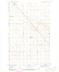
1949 Map of Bantry
USGS Topo · Published 1981About this map
The small town of Bantry sits at the northern edge of this McHenry County landscape, defined by its position along the Burlington Northern railroad line. This survey, mapped originally in 1949 and later updated in the early 1980s, captures a rural prairie environment organized by the townships of Bantry and Wagar. The map documents the persistent agricultural infrastructure of the region, including scattered windmills and the Pipeline corridor that cuts diagonally across the southern sections.
Find a feature on this map
9 named features on this map. Tap any name to fly to it.
Don’t see what you’re looking for? This feature index may not catch every label — zoom into the map to look around manually.
Map Details
Editions of this 1949 Bantry Map
This is the sole edition of this map. No revisions or reprints were ever made.
Other maps of this area
1949 · Riga
USGS Topo · 1:24,000
1949 · Denbigh
USGS Topo · 1:24,000
1950 · Towner NW
USGS Topo · 1:24,000
1950 · Upham SE
USGS Topo · 1:24,000
1950 · Towner
USGS Topo · 1:24,000
1950 · Upham
USGS Topo · 1:24,000
1950 · Willow City SW
USGS Topo · 1:24,000
1950 · Denbigh
USGS Topo · 1:24,000
1950 · Bantry NW
USGS Topo · 1:24,000
1950 · Bantry
USGS Topo · 1:24,000