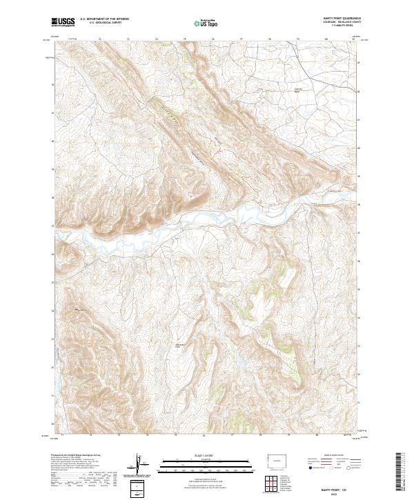
2022 Map of Banty Point
USGS Topo · Published 2022About this map
The White River carves through the heart of this landscape in Rio Blanco County, defining a topography of deep drainages and prominent ridges. This high-desert terrain is marked by significant elevation shifts, from the heights of Raven Ridge and the distinct peak at Banty Point down to the open expanse of Shavetail Park. The network of seasonal watercourses, including Shavetail Wash and Cottonwood Creek, illustrates the complex erosion patterns characteristic of the region's sedimentary geology.
Find a feature on this map
18 named features on this map. Tap any name to fly to it.
Don’t see what you’re looking for? This feature index may not catch every label — zoom into the map to look around manually.
Map Details
Editions of this 2022 Banty Point Map
This is the sole edition of this map. No revisions or reprints were ever made.
Other maps of this area

1885 · East Tavaputs
USGS Topo · 1:250,000

1885 · Ashley
USGS Topo · 1:250,000

1907 · Rangely
USGS Topo · 1:125,000

1907 · Jensen
USGS Topo · 1:125,000

1910 · Jensen
USGS Topo · 1:125,000

1910 · Rangely
USGS Topo · 1:125,000

1954 · Vernal
USGS Topo · 1:250,000

1956 · Grand Junction
USGS Topo · 1:250,000

1958 · Vernal
USGS Topo · 1:250,000

1959 · Grand Junction
USGS Topo · 1:250,000