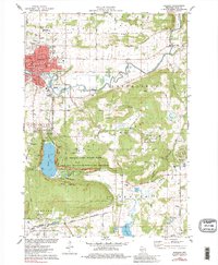
1975 Map of Baraboo
USGS Topo · Published 1984About this map
Devils Lake State Park and the rugged topography of the Baraboo Range define this mid-1970s landscape. This survey documents a critical conservation era, highlighting the Ice Age National Scientific Reserve alongside the massive Badger Army Ammunition Plant to the south. The city of Baraboo serves as the regional hub, where the Baraboo River meanders past the Fairground and local institutions like St Josephs Sch and the Courthouse.
Find a feature on this map
63 named features on this map. Tap any name to fly to it.
Don’t see what you’re looking for? This feature index may not catch every label — zoom into the map to look around manually.
Map Details
Editions of this 1975 Baraboo Map
2 editions found
Other maps of this area

1895 · Baraboo
USGS Topo · 1:62,500

1901 · Denzer
USGS Topo · 1:62,500

1901 · The Dells
USGS Topo · 1:62,500

1902 · Briggsville
USGS Topo · 1:62,500

1908 · Baraboo
USGS Topo · 1:62,500

1957 · Wisconsin Dells
USGS Topo · 1:62,500

1957 · Madison
USGS Topo · 1:250,000

1958 · Briggsville
USGS Topo · 1:62,500

1958 · North Freedom
USGS Topo · 1:62,500

1959 · Baraboo
USGS Topo · 1:62,500