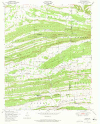
1947 Map of Barber
USGS Topo · Published 1973About this map
The Camp Chaffee Military Reservation dominates the northern landscape of this region, its boundary cutting through the prominent ridges of Backbone Mountain and Washburn Ridge. Below these heights, the southern half of the map reveals a rural settlement pattern centered on the small village of Barber and the community of Washburn. This area is characterized by a series of parallel ridges, including Blythe Ridge and Green Ridge, which dictate the flow of local waterways like Washburn Creek and Polecat Branch.
Find a feature on this map
38 named features on this map. Tap any name to fly to it.
Don’t see what you’re looking for? This feature index may not catch every label — zoom into the map to look around manually.
Map Details
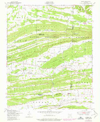
Editions of this 1947 Barber Map
2 editions found
Other maps of this area

1887 · Magazine Mountain #2
USGS Topo · 1:62,500

1887 · Magazine Mountain #3
USGS Topo · 1:62,500

1887 · Magazine Mountain
USGS Topo · 1:62,500

1890 · Magazine Mountain
USGS Topo · 1:125,000

1890 · Fort Smith
USGS Topo · 1:125,000

1906 · Lavaca
USGS Topo · 1:62,500

1906 · Barber
USGS Topo · 1:62,500

1934 · Booneville
USGS Topo · 1:48,000

1939 · Booneville
USGS Topo · 1:62,500

1943 · Fort Smith
USGS Topo · 1:125,000