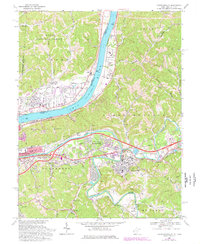
1968 Map of Barboursville
USGS Topo · Published 1977About this map
The Ohio River and Guyandotte River converge near this 1968 landscape, framing a period of mid-century suburban expansion and industrial transport. The township of Barboursville and emerging neighborhoods like East Pea Ridge and West Pea Ridge define the West Virginia side, while Proctorville and Rome anchor the Ohio riverbank. This era shows a community in transition, where new developments and golf courses like the Glenbrier Country Club sit alongside established landmarks such as the County Fairground and numerous local congregations, including White Chapel and Spirit Chapel.
Find a feature on this map
74 named features on this map. Tap any name to fly to it.
Don’t see what you’re looking for? This feature index may not catch every label — zoom into the map to look around manually.
Map Details
Editions of this 1968 Barboursville Map
3 editions found
Other maps of this area

1892 · Huntington
USGS Topo · 1:125,000

1898 · Huntington
USGS Topo · 1:125,000

1901 · Guyandot
USGS Topo · 1:62,500

1902 · Guyandot
USGS Topo · 1:62,500

1902 · Milton
USGS Topo · 1:62,500

1906 · Athalia
USGS Topo · 1:62,500

1906 · Glenwood
USGS Topo · 1:62,500

1908 · Athalia
USGS Topo · 1:62,500

1908 · Glenwood
USGS Topo · 1:62,500

1931 · Milton
USGS Topo · 1:62,500