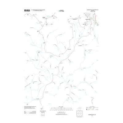
2013 Map of Barbourville
USGS Topo · Published 2013About this map
Barbourville serves as the focal point for this Knox County landscape, where Richland Cr meets the winding Cumberland River. The town's grid extends toward Apple Grove and Providence, while the surrounding terrain is defined by a dense network of hollows and family-named landmarks. The mapping detail reveals a rural society built around the river's bends, such as Mackey Bend, and the gaps between ridges like Logan Gap and Mossy Gap.
Find a feature on this map
141 named features on this map. Tap any name to fly to it.
Don’t see what you’re looking for? This feature index may not catch every label — zoom into the map to look around manually.
Map Details
Editions of this 2013 Barbourville Map
This is the sole edition of this map. No revisions or reprints were ever made.
Other maps of this area

1886 · Cumberland Gap
USGS Topo · 1:125,000

1888 · Cumberland Gap
USGS Topo · 1:125,000

1890 · Williamsburg
USGS Topo · 1:125,000

1891 · Cumberland Gap
USGS Topo · 1:125,000

1894 · Williamsburg
USGS Topo · 1:125,000

1952 · Corbin
USGS Topo · 1:24,000

1952 · Barbourville
USGS Topo · 1:24,000

1952 · Heidrick
USGS Topo · 1:24,000

1952 · Fount
USGS Topo · 1:24,000

1952 · Saxton
USGS Topo · 1:24,000