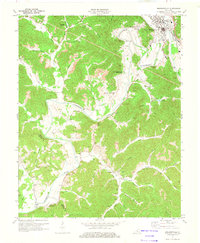
1974 Map of Barbourville
USGS Topo · Published 1975About this map
The Cumberland River carves a winding path through this portion of Knox County, anchoring the regional hub of Barbourville and the campus of Union College. By the mid-1970s, the landscape reflects a complex layering of education, recreation, and heavy industry. While Walker Memorial State Park preserves the river's bends, the surrounding ridges are heavily marked by extensive Strip Mine operations and numerous Oil Wells, particularly near Horseshoe Bend and Logan Hollow.
Find a feature on this map
77 named features on this map. Tap any name to fly to it.
Don’t see what you’re looking for? This feature index may not catch every label — zoom into the map to look around manually.
Map Details
Editions of this 1974 Barbourville Map
This is the sole edition of this map. No revisions or reprints were ever made.
Other maps of this area

1886 · Cumberland Gap
USGS Topo · 1:125,000

1888 · Cumberland Gap
USGS Topo · 1:125,000

1890 · Williamsburg
USGS Topo · 1:125,000

1891 · Cumberland Gap
USGS Topo · 1:125,000

1894 · Williamsburg
USGS Topo · 1:125,000

1952 · Corbin
USGS Topo · 1:24,000

1952 · Barbourville
USGS Topo · 1:24,000

1952 · Heidrick
USGS Topo · 1:24,000

1952 · Fount
USGS Topo · 1:24,000

1952 · Saxton
USGS Topo · 1:24,000