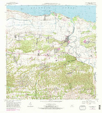
1969 Map of Barceloneta
USGS Topo · Published 1983About this map
Barceloneta stands as the primary urban center in this coastal survey, situated where the Rio Grande De Manati winds toward the Atlantic Ocean. The landscape transitions from the northern marshlands of Caño Tiburones to the dense, limestone hills of Florida Afuera and Sabana Hoyos in the south. This era shows the region's agricultural and industrial infrastructure, notably the Central Plazuela and the Via Ferrocarril railroad line that serviced the sugar economy.
Find a feature on this map
65 named features on this map. Tap any name to fly to it.
Don’t see what you’re looking for? This feature index may not catch every label — zoom into the map to look around manually.
Map Details
Editions of this 1969 Barceloneta Map
3 editions found
Other maps of this area

1942 · Manati
USGS Topo · 1:30,000

1942 · Arecibo
USGS Topo · 1:30,000

1942 · Barceloneta
USGS Topo · 1:30,000

1943 · Utuado NE
USGS Topo · 1:10,000

1946 · Barceloneta
USGS Topo · 1:30,000

1946 · Utuado
USGS Topo · 1:30,000

1946 · Ciales
USGS Topo · 1:30,000

1946 · Arecibo
USGS Topo · 1:30,000

1946 · Florida
USGS Topo · 1:30,000

1946 · Manati
USGS Topo · 1:30,000