
1946 Map of Manati
USGS Topo · Published 1946About this map
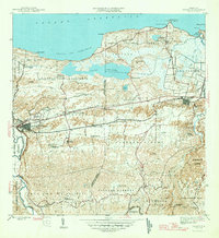
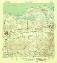
The agricultural heart of northern Puerto Rico unfolds across this mid-century survey, centered on the bustling town of Manatí and the coastal landscapes of the Océano Atlántico. The region's economy at this time is clearly defined by the sprawling sugar plantation system, evidenced by numerous named agricultural estates such as Colonia Coto Norte, Colonia Sábana Seca, and Colonia Félix Córdova Dávila. These colonias are interconnected by the American Railroad of Porto Rico, which cuts through the center of the sheet alongside the primary roadway. The diverse terrain transitions from the marshy wetlands of Laguna Tortuguero and Caño Tiburones in the north to the increasingly steep hills of the interior. Religious life and community focal points are marked by sites like the Capilla de la Virgen del Carmen and the southern Iglesia Santos Apóstoles, while the Río Grande de Manatí anchors the western boundary of the district.
Find a feature on this map
56 named features on this map. Tap any name to fly to it.
Don’t see what you’re looking for? This feature index may not catch every label — zoom into the map to look around manually.
Map Details
Editions of this 1946 Manati Map
3 editions found
Other maps of this area

1940 · Vega Alta
USGS Topo · 1:30,000

1942 · Manati
USGS Topo · 1:30,000

1942 · Barceloneta
USGS Topo · 1:30,000

1946 · Corozal
USGS Topo · 1:30,000

1946 · Barceloneta
USGS Topo · 1:30,000

1946 · Ciales
USGS Topo · 1:30,000

1946 · Florida
USGS Topo · 1:30,000

1946 · Vega Alta
USGS Topo · 1:30,000

1947 · Corozal NO
USGS Topo · 1:10,000
1947 · Ciales NO
USGS Topo · 1:10,000