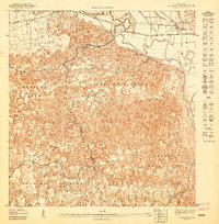
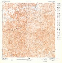
1947 Map of Barceloneta SE
USGS Topo · Published 1947About this map
The Central Monserrate sugar mill stands as a prominent industrial landmark on the north bank of the Rio Grande de Manati, anchoring this mid-century survey of the coastal plain. The landscape is defined by the sharp transition between the alluvial valley and the intricate karst topography that rises to the south. Transport during this era is dominated by the American Railroad de Porto Rico, which skirts the northern edge of the terrain to serve the local sugar industry and connect the coastal settlements. Extensive barrio divisions including Bajura Afuera, Florida Afuera, and Rio Arriba Poniente illustrate the dense administrative patchwork of the region. The map reveals a mix of clustered settlements like El Cachete and scattered rural habitations linked by a burgeoning Linea de Transmisión, reflecting the post-war modernization of the Puerto Rican interior.
Find a feature on this map
12 named features on this map. Tap any name to fly to it.
Don’t see what you’re looking for? This feature index may not catch every label — zoom into the map to look around manually.
Map Details
Editions of this 1947 Barceloneta SE Map
This is the sole edition of this map. No revisions or reprints were ever made.
Other maps of this area

1942 · Manati
USGS Topo · 1:30,000

1942 · Barceloneta
USGS Topo · 1:30,000

1946 · Barceloneta
USGS Topo · 1:30,000

1946 · Ciales
USGS Topo · 1:30,000

1946 · Florida
USGS Topo · 1:30,000

1946 · Manati
USGS Topo · 1:30,000
1947 · Barceloneta SO
USGS Topo · 1:10,000
1947 · Ciales NO
USGS Topo · 1:10,000
1947 · Florida NO
USGS Topo · 1:10,000
1947 · Florida NE
USGS Topo · 1:10,000
Featured Places
- Sector Ceiba, Manatí
- Florida Afuera, Barceloneta
- Tierras Nuevas Saliente, Manatí
- Pajonal, Florida
- Bajura Afuera, Manatí