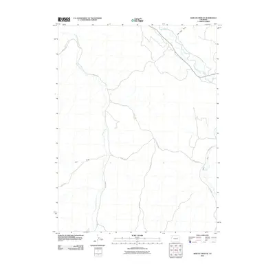
2010 Map of Barcus Creek SE
USGS Topo · Published 2010About this map
The White River winds through the northern portion of this Rio Blanco County landscape, serving as a primary drainage for the surrounding high desert terrain. The area is defined by a network of seasonal watercourses and topographic depressions, including the broad Alkali Flat and the etched path of Tom Little Draw. This region of Colorado is dominated by significant tributary systems, with Yellow Creek and Barcus Creek cutting through the western section, while Piceance Creek enters from the southeast. The map reveals a remote infrastructure of backcountry roads such as County Rd 20 and County Rd 88, which follow the natural contours of the gulches and valleys. These routes connect the varied terrain of Pinto Gulch to the river corridor, illustrating how local transit in this part of the state remains tied to the underlying geology and drainage patterns.
Find a feature on this map
11 named features on this map. Tap any name to fly to it.
Don’t see what you’re looking for? This feature index may not catch every label — zoom into the map to look around manually.
Map Details
Editions of this 2010 Barcus Creek SE Map
This is the sole edition of this map. No revisions or reprints were ever made.
Other maps of this area

1907 · White River
USGS Topo · 1:125,000

1910 · White River
USGS Topo · 1:125,000

1952 · Wolf Ridge
USGS Topo · 1:24,000

1952 · Greasewood Gulch
USGS Topo · 1:24,000

1952 · Square S Ranch
USGS Topo · 1:24,000

1954 · Vernal
USGS Topo · 1:250,000

1956 · Grand Junction
USGS Topo · 1:250,000

1958 · Vernal
USGS Topo · 1:250,000

1959 · Grand Junction
USGS Topo · 1:250,000

1960 · Vernal
USGS Topo · 1:250,000