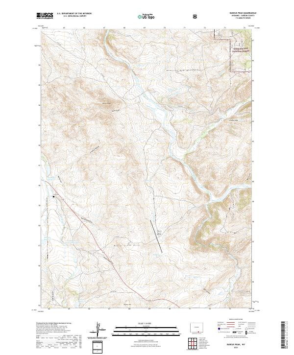
2021 Map of Barcus Peak
USGS Topo · Published 2021About this map
The North Platte River winds through this Carbon County landscape, supporting a network of early irrigation infrastructure like the Barcus Ditch and Rocky Point Ditch. Agricultural and ranching heritage is central to this area, evidenced by landmarks like the A Bar A Ranch Airport and several localized water storage projects including Toothaker Reservoir and Rollman Reservoir. The terrain rises toward the Medicine Bow Mountains in the east, with the Medicine Bow National Forest covering the higher elevations. Genealogy researchers will find the Platt Cem located near the intersection of Beaver Creek Rd and the Toothaker Ditch Number 2. The map also captures the varied topography of the Beaver Creek Hills and prominent heights such as Barcus Peak and Jenkins Peak, providing a clear record of the rural land divisions and family-named landmarks that define this Wyoming valley.
Find a feature on this map
50 named features on this map. Tap any name to fly to it.
Don’t see what you’re looking for? This feature index may not catch every label — zoom into the map to look around manually.
Map Details
Editions of this 2021 Barcus Peak Map
This is the sole edition of this map. No revisions or reprints were ever made.
Other maps of this area

1906 · Medicine Bow
USGS Topo · 1:125,000

1908 · Medicine Bow
USGS Topo · 1:125,000

1939 · Saratoga
USGS Topo · 1:125,000

1954 · Rawlins
USGS Topo · 1:250,000

1958 · Rawlins
USGS Topo · 1:250,000
1961 · Elkhorn Point
USGS Topo · 1:24,000

1961 · Overlook Hill
USGS Topo · 1:24,000

1961 · Ryan Park
USGS Topo · 1:24,000

1961 · Gunst Reservoir
USGS Topo · 1:24,000
1961 · Trent Creek
USGS Topo · 1:24,000