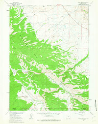
1961 Map of Trent Creek
USGS Topo · Published 1963About this map
Medicine Bow National Forest dominates this high-country landscape along the Wyoming-Colorado border, where the Continental Divide forms a significant topographical partition. The map illustrates a remote terrain defined by high-altitude meadows known as parks, including Casteel Park, North Cunningham Park, and Holroyd Park. These open spaces are fed by a complex drainage system of creeks such as Big Creek and Trent Creek, while the presence of the Casteel Ditch and various Jeep Trails indicates early water management and backcountry access for ranching and forest management. Small-scale industrial activity is evidenced by a Mine and Prospect located near the southern border, while the Big Creek Guard Station and Skyline Ranch stand as rare points of habitation in this wilderness area, which spans across Carbon County, Wyoming, and into the northern reaches of Colorado.
Find a feature on this map
35 named features on this map. Tap any name to fly to it.
Don’t see what you’re looking for? This feature index may not catch every label — zoom into the map to look around manually.
Map Details
Editions of this 1961 Trent Creek Map
3 editions found
Other maps of this area

1906 · Medicine Bow
USGS Topo · 1:125,000

1908 · Medicine Bow
USGS Topo · 1:125,000

1911 · Hahns Peak
USGS Topo · 1:125,000

1913 · Hahns Peak
USGS Topo · 1:125,000

1939 · Saratoga
USGS Topo · 1:125,000

1954 · Rawlins
USGS Topo · 1:250,000

1954 · Craig
USGS Topo · 1:250,000

1955 · Davis Peak
USGS Topo · 1:24,000

1955 · Independence Mountain
USGS Topo · 1:24,000

1955 · Pearl
USGS Topo · 1:24,000