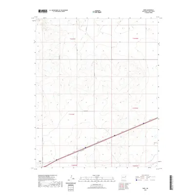
2020 Map of Bard
USGS Topo · Published 2020About this map
Bard sits at the southwestern edge of this high plains landscape, situated near the intersection of the Q Ranch To Market Rd and several arterial ranch roads. This corner of eastern Quay County is defined by a rigorous grid of section lines and gravel routes, including Quay Road 63 and Quay Road 60, which carve through the shortgrass prairie. The topography is marked by the drainage basins of Frost Cr and Trujillo Cr, which create subtle variations in the otherwise level terrain. To the southeast, the Endee Cem stands as a significant point of interest for genealogists and local historians, serving as a quiet witness to the ranching families who settled this region of the Llano Estacado. The map's layout of townships and ranges reflects the enduring legacy of the Public Land Survey System in organizing this rural New Mexico territory.
Find a feature on this map
22 named features on this map. Tap any name to fly to it.
Don’t see what you’re looking for? This feature index may not catch every label — zoom into the map to look around manually.
Map Details
Editions of this 2020 Bard Map
This is the sole edition of this map. No revisions or reprints were ever made.
Other maps of this area

1954 · Tucumcari
USGS Topo · 1:250,000

1958 · Tucumcari
USGS Topo · 1:250,000

1962 · Logan
USGS Topo · 1:62,500

1968 · Porter
USGS Topo · 1:24,000

1968 · Rock Camp
USGS Topo · 1:24,000

1968 · Blue Hole
USGS Topo · 1:24,000

1968 · Riley Camp
USGS Topo · 1:24,000

1968 · San Jon
USGS Topo · 1:24,000

1968 · Bard
USGS Topo · 1:24,000

1968 · Glenrio
USGS Topo · 1:24,000