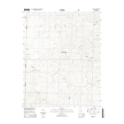
2015 Map of Bardley
USGS Topo · Published 2015About this map
Mark Twain National Forest dominates much of this Ozark landscape along the border of Oregon and Ripley counties. Small communities like Bardley and Bennett serve as anchors in a terrain defined by deep drainages and ridges, including Schoolhouse Hollow, Mill Hollow, and Wolf Mtn. The hydrology of the region is complex, with Blue Hole Spring feeding into a network of waterways such as N Fork Buffalo Cr and Fourche Cr, the latter of which flows into Fourche Lake in the southern portion of the quadrangle.
Find a feature on this map
37 named features on this map. Tap any name to fly to it.
Don’t see what you’re looking for? This feature index may not catch every label — zoom into the map to look around manually.
Map Details
Editions of this 2015 Bardley Map
This is the sole edition of this map. No revisions or reprints were ever made.
Other maps of this area

1939 · Doniphan
USGS Topo · 1:62,500

1941 · Gatewood
USGS Topo · 1:62,500

1944 · Van Buren
USGS Topo · 1:62,500

1944 · Grandin
USGS Topo · 1:62,500

1945 · Doniphan
USGS Topo · 1:62,500

1945 · Gatewood
USGS Topo · 1:62,500

1946 · Grandin
USGS Topo · 1:62,500

1946 · Van Buren
USGS Topo · 1:62,500

1957 · Poplar Bluff
USGS Topo · 1:250,000

1959 · Poplar Bluff
USGS Topo · 1:250,000