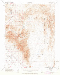
1954 Map of Bare Mtn
USGS Topo · Published 1963About this map
The mining-scarred landscape of Bare Mountain reveals a legacy of silver, gold, and fluorspar extraction during the mid-20th century. While Beatty serves as the primary hub along U.S. 95 and the Amargosa River, the map documents the fading footprint of earlier boom periods through features like the Ruins of Carrara. This settlement, once a company town for marble quarrying, is shown here as the rail infrastructure that once served it begins to vanish. Both the Tidewater and Tonopah RR and the Bullfrog Gold Field RR are marked as dismantled, tracing ghostly paths through the desert floor.
Find a feature on this map
65 named features on this map. Tap any name to fly to it.
Don’t see what you’re looking for? This feature index may not catch every label — zoom into the map to look around manually.
Map Details
Editions of this 1954 Bare Mtn Map
3 editions found

Other maps of this area

1908 · Kawich
USGS Topo · 1:250,000

1908 · Furnace Creek
USGS Topo · 1:250,000

1910 · Furnace Creek
USGS Topo · 1:250,000

1942 · Tolicha Peak
USGS Topo · 1:125,000

1942 · Wheelbarrow Peak
USGS Topo · 1:125,000

1942 · Skull Mountain
USGS Topo · 1:125,000

1942 · Bullfrog
USGS Topo · 1:125,000

1948 · Death Valley
USGS Topo · 1:250,000

1952 · Chloride Cliff
USGS Topo · 1:50,000

1952 · Topopah Spring
USGS Topo · 1:62,500