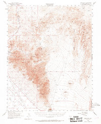
1954 Map of Bare Mtn
USGS Topo · Published 1969About this map
Bare Mountain dominates this Nevada landscape, standing as a prominent geological barrier between the Oasis Valley to the west and the volcanic expanses of Crater Flat to the east. The 1950s era of this survey shows the fading footprint of early 20th-century industry, most notably the path of the Tidewater and Tonopah Railroad (Dismantled) cutting through the Amargosa Narrows. Mining activity is heavily concentrated along the western flanks of the range, including the Diamond Queen Mine, Gold Ace Mines, and Fluorspar Mine.
Find a feature on this map
49 named features on this map. Tap any name to fly to it.
Don’t see what you’re looking for? This feature index may not catch every label — zoom into the map to look around manually.
Map Details
Editions of this 1954 Bare Mtn Map
3 editions found

Other maps of this area

1908 · Kawich
USGS Topo · 1:250,000

1908 · Furnace Creek
USGS Topo · 1:250,000

1910 · Furnace Creek
USGS Topo · 1:250,000

1942 · Tolicha Peak
USGS Topo · 1:125,000

1942 · Wheelbarrow Peak
USGS Topo · 1:125,000

1942 · Skull Mountain
USGS Topo · 1:125,000

1942 · Bullfrog
USGS Topo · 1:125,000

1948 · Death Valley
USGS Topo · 1:250,000

1952 · Chloride Cliff
USGS Topo · 1:50,000

1952 · Topopah Spring
USGS Topo · 1:62,500