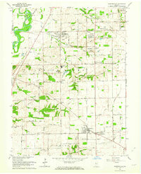
1962 Map of Bargersville
USGS Topo · Published 1963About this map
Bargersville and its predecessor, Old Bargersville, anchor this mid-century view of central Indiana, where the Illinois Central Railroad cuts a diagonal path through the landscape. The geography is defined by the White River and its accompanying White River Valley along the western edge, providing a sharp contrast to the geometric agricultural grids of the interior. This era shows the expansion of residential communities like Smith Valley and El Dorado alongside established crossroads such as Stones Crossing and Kinder.
Find a feature on this map
64 named features on this map. Tap any name to fly to it.
Don’t see what you’re looking for? This feature index may not catch every label — zoom into the map to look around manually.
Map Details
Editions of this 1962 Bargersville Map
4 editions found
Other maps of this area

1942 · Franklin
USGS Topo · 1:125,000

1947 · Franklin
USGS Topo · 1:62,500

1948 · Franklin
USGS Topo · 1:24,000

1948 · Maywood
USGS Topo · 1:24,000

1948 · Beech Grove
USGS Topo · 1:24,000

1948 · Trafalgar
USGS Topo · 1:24,000

1950 · Franklin
USGS Topo · 1:62,500

1952 · Bargersville
USGS Topo · 1:24,000

1953 · Greenwood
USGS Topo · 1:24,000

1953 · Bridgeport
USGS Topo · 1:24,000