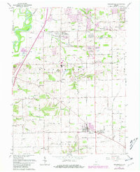
1962 Map of Bargersville
USGS Topo · Published 1981About this map
Bargersville and its predecessor, Old Bargersville, anchor the southeastern portion of this Johnson County landscape, illustrating the migration of local centers toward newer transportation corridors. The map records a transition from rural farmsteads to emerging suburban patterns, particularly around Smith Valley and the Center Grove High Sch. Small, established hamlets such as Stones Crossing, Kinder, and Banta dot the central and western sections, many defined by their proximity to local watercourses like Honey Creek and Turkey Run. Numerous family-named burial grounds, including the Henderson Cem, Mallow Cem, and McColgin Cem, provide significant genealogical markers for the area. The western edge is defined by the White River and the prominent rising terrain of The Bluffs, while the eastern portion shows the steady drainage network of Youngs Creek and the Alexander Ditch.
Find a feature on this map
61 named features on this map. Tap any name to fly to it.
Don’t see what you’re looking for? This feature index may not catch every label — zoom into the map to look around manually.
Map Details
Editions of this 1962 Bargersville Map
4 editions found
Other maps of this area

1942 · Franklin
USGS Topo · 1:125,000

1947 · Franklin
USGS Topo · 1:62,500

1948 · Franklin
USGS Topo · 1:24,000

1948 · Maywood
USGS Topo · 1:24,000

1948 · Beech Grove
USGS Topo · 1:24,000

1948 · Trafalgar
USGS Topo · 1:24,000

1950 · Franklin
USGS Topo · 1:62,500

1952 · Bargersville
USGS Topo · 1:24,000

1953 · Greenwood
USGS Topo · 1:24,000

1953 · Bridgeport
USGS Topo · 1:24,000