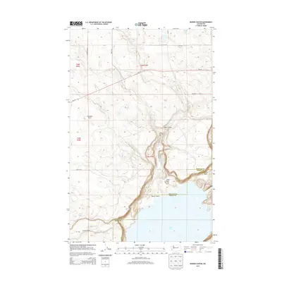
2014 Map of Barker Canyon
USGS Topo · Published 2014About this map
Barker Canyon defines this portion of the Grant County landscape, where the dramatic elevation shifts of the Coulee Region meet the plateau. In the southern half of the sheet, the expansive waters of Banks Lake dominate the terrain, a primary feature of the Columbia Basin Project's irrigation network. The map captures a transition between the high, relatively flat agricultural lands to the north and the complex geological formations to the south. Small settlements like Sanderson and the intersection at Four Corners represent the rural community hubs of the early 21st century. Notable geological landmarks including Steamboat Butte, Cache Butte, and Barker Butte rise above the canyon floor, while smaller water bodies like Barker Canyon Lake and Wilson Lake provide isolated points of interest amidst the desert-like environment and technical road networks such as Wa-174.
Find a feature on this map
21 named features on this map. Tap any name to fly to it.
Don’t see what you’re looking for? This feature index may not catch every label — zoom into the map to look around manually.
Map Details
Editions of this 2014 Barker Canyon Map
This is the sole edition of this map. No revisions or reprints were ever made.
Other maps of this area

1950 · Boot Mtn
USGS Topo · 1:62,500

1950 · Alameda Flat
USGS Topo · 1:62,500

1952 · Alameda Flat
USGS Topo · 1:62,500

1953 · Ritzville
USGS Topo · 1:250,000

1954 · Okanogan
USGS Topo · 1:250,000

1958 · Okanogan
USGS Topo · 1:250,000

1959 · Ritzville
USGS Topo · 1:250,000

1965 · Ritzville
USGS Topo · 1:250,000

1968 · Steamboat Rock SW
USGS Topo · 1:24,000

1968 · Barker Canyon
USGS Topo · 1:24,000