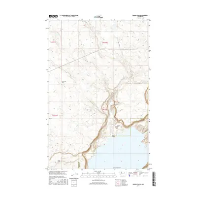
2017 Map of Barker Canyon
USGS Topo · Published 2017About this map
Banks Lake dominates the southern landscape of this Grant County region, where the steep basalt walls of the Upper Grand Coulee meet the open plateau. The terrain is defined by dramatic geological remnants such as Steamboat Butte and the landmark Steamboat Rock at the water's edge, illustrating the glacial flood history of the Columbia Basin. Barker Canyon cuts a deep path through the center of the sheet, leading past Barker Canyon Lake toward the larger reservoir. This 2017 survey reveals a sparsely populated area characterized by local access routes like Barker Canyon Rd and Rd 26 NE that navigate the high ground above Foster Coulee. The map provides a precise view of the complex topography and drainage patterns between Barker Butte and Cache Butte, detailing the transition from high arid plains to the coulee floor.
Find a feature on this map
20 named features on this map. Tap any name to fly to it.
Don’t see what you’re looking for? This feature index may not catch every label — zoom into the map to look around manually.
Map Details
Editions of this 2017 Barker Canyon Map
This is the sole edition of this map. No revisions or reprints were ever made.
Other maps of this area

1950 · Boot Mtn
USGS Topo · 1:62,500

1950 · Alameda Flat
USGS Topo · 1:62,500

1952 · Alameda Flat
USGS Topo · 1:62,500

1953 · Ritzville
USGS Topo · 1:250,000

1954 · Okanogan
USGS Topo · 1:250,000

1958 · Okanogan
USGS Topo · 1:250,000

1959 · Ritzville
USGS Topo · 1:250,000

1965 · Ritzville
USGS Topo · 1:250,000

1968 · Steamboat Rock SW
USGS Topo · 1:24,000

1968 · Barker Canyon
USGS Topo · 1:24,000