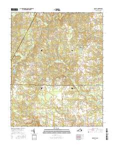
2016 Map of Barley
USGS Topo · Published 2016About this map
The Virginia and North Carolina border bisects this landscape, dividing the northern reaches of Northampton County from Virginia's Greensville and Brunswick counties. Agricultural patterns and rural homesteads define the area, centered on the crossroads at Barley and Gum Forks. The water-driven industry of the past is represented by Garners Mill and the adjacent Garners Millpond, while family history is etched into the land through numerous private burial grounds like Smith Cem, Rook Cem, and Massey Cem.
Find a feature on this map
80 named features on this map. Tap any name to fly to it.
Don’t see what you’re looking for? This feature index may not catch every label — zoom into the map to look around manually.
Map Details
Editions of this 2016 Barley Map
This is the sole edition of this map. No revisions or reprints were ever made.
Other maps of this area

1919 · White Plains
USGS Topo · 1:48,000

1919 · Emporia
USGS Topo · 1:62,500

1920 · White Plains
USGS Topo · 1:62,500

1942 · Emporia
USGS Topo · 1:62,500

1953 · Norfolk
USGS Topo · 1:250,000

1963 · Powellton
USGS Topo · 1:24,000

1963 · Skippers
USGS Topo · 1:24,000

1963 · Barley
USGS Topo · 1:24,000

1963 · Emporia
USGS Topo · 1:24,000

1963 · Ante
USGS Topo · 1:24,000