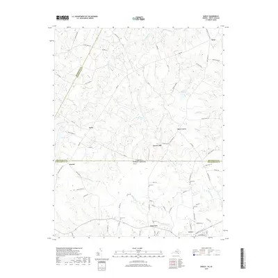
2019 Map of Barley
USGS Topo · Published 2019About this map
Garners Mill and the surrounding borderlands of the Virginia and North Carolina line define this survey of rural Northampton and Greensville counties. The landscape is heavily marked by small family settlements and crossroads like Stancell, Barley, and Slates Corner, connected by a network of timber and farm roads such as Pine Logging Rd and Fish Rd. Numerous family burial grounds, including Smith Cem, Massey Cem, and Rook Cem, are preserved across the terrain, indicating long-standing land ownership patterns and providing significant data for genealogical research. Waterways like Fountains Creek and Beaver Pond Cr wind through the area, supporting localized industry and drainage for the agricultural plots that dominate the region. The settlement of Gaston sits at the southern edge, while Brink anchors the northern reaches, illustrating the persistent rural character of these coastal plain border communities.
Find a feature on this map
81 named features on this map. Tap any name to fly to it.
Don’t see what you’re looking for? This feature index may not catch every label — zoom into the map to look around manually.
Map Details
Editions of this 2019 Barley Map
This is the sole edition of this map. No revisions or reprints were ever made.
Other maps of this area

1919 · White Plains
USGS Topo · 1:48,000

1919 · Emporia
USGS Topo · 1:62,500

1920 · White Plains
USGS Topo · 1:62,500

1942 · Emporia
USGS Topo · 1:62,500

1953 · Norfolk
USGS Topo · 1:250,000

1963 · Powellton
USGS Topo · 1:24,000

1963 · Skippers
USGS Topo · 1:24,000

1963 · Barley
USGS Topo · 1:24,000

1963 · Emporia
USGS Topo · 1:24,000

1963 · Ante
USGS Topo · 1:24,000