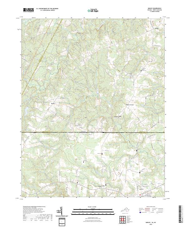
2022 Map of Barley
USGS Topo · Published 2022About this map
The state line between Virginia and North Carolina bisects this landscape, separating the rural reaches of Greensville and Brunswick Counties from Northampton County. The town of Gaston anchors the southern portion of the map, while small crossroads settlements like Barley, Brink, and Gum Forks define the northern upland. This region is characterized by a dense network of family-named cemeteries and rural churches, including the Forest Hill Baptist Church and its associated cemetery. The terrain is shaped by the winding course of Fountains Creek and Beaver Pond Creek, with industrial history evidenced at Garners Mill and several ponds like Rainey Pond and Smith Pond. Extensive tracts such as Sherwood Forest and Seward Forest highlight the importance of timber and land management in this border country.
Find a feature on this map
87 named features on this map. Tap any name to fly to it.
Don’t see what you’re looking for? This feature index may not catch every label — zoom into the map to look around manually.
Map Details
Editions of this 2022 Barley Map
This is the sole edition of this map. No revisions or reprints were ever made.
Other maps of this area

1919 · White Plains
USGS Topo · 1:48,000

1919 · Emporia
USGS Topo · 1:62,500

1920 · White Plains
USGS Topo · 1:62,500

1942 · Emporia
USGS Topo · 1:62,500

1953 · Norfolk
USGS Topo · 1:250,000

1963 · Powellton
USGS Topo · 1:24,000

1963 · Skippers
USGS Topo · 1:24,000

1963 · Barley
USGS Topo · 1:24,000

1963 · Emporia
USGS Topo · 1:24,000

1963 · Ante
USGS Topo · 1:24,000