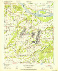
1951 Map of Barling
USGS Topo · Published 1951About this map
Camp Chaffee dominates the landscape of Sebastian County in the early postwar era, showing the extensive infrastructure of the military installation including a massive grid of barracks, an athletic field, and its own Roberts Cem. The surrounding civilian area transitions from the riverside settlement at Haroldton near the Arkansas River to the growing community of Barling. Transportation and health infrastructure are prominent, with the Missouri Pacific railroad cutting through the territory and a localized tuberculosis sanatorium perched on Wildcat Mountain. South of the military reservation, the map reveals a rural landscape defined by education and faith, featuring the Howard Hill School and the Rye Hill Church. This survey captures the region just as the Fort Smith Municipal Airport was undergoing construction, signaling a shift toward modern aviation alongside the area's established coal mining and agriculture.
Find a feature on this map
42 named features on this map. Tap any name to fly to it.
Don’t see what you’re looking for? This feature index may not catch every label — zoom into the map to look around manually.
Map Details
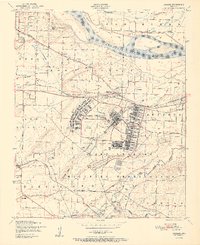
Editions of this 1951 Barling Map
2 editions found
Other maps of this area

1879 · Fort Smith
USGS Topo · 1:62,500

1887 · Van Buren
USGS Topo · 1:62,500

1887 · Greenwood
USGS Topo · 1:62,500

1890 · Fort Smith
USGS Topo · 1:125,000

1906 · Lavaca
USGS Topo · 1:62,500

1906 · Barber
USGS Topo · 1:62,500

1943 · Fort Smith
USGS Topo · 1:125,000

1946 · Fort Smith
USGS Topo · 1:250,000

1947 · Lavaca
USGS Topo · 1:62,500

1947 · Van Buren
USGS Topo · 1:62,500