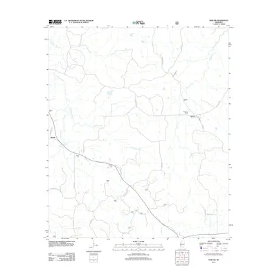
2012 Map of Barlow
USGS Topo · Published 2012About this map
Barlow and Burnell anchor this rural landscape in southwestern Mississippi, where the headwaters of Little Bayou Pierre and its many tributaries, such as Brandywine Cr and Bobs Br, define the terrain. The area is characterized by a network of winding local roads named for established families, including Henneberry Rd, Vardaman Rd, and Shelton Weeks Rd.
Find a feature on this map
32 named features on this map. Tap any name to fly to it.
Don’t see what you’re looking for? This feature index may not catch every label — zoom into the map to look around manually.
Map Details
Editions of this 2012 Barlow Map
This is the sole edition of this map. No revisions or reprints were ever made.
Other maps of this area

1953 · Natchez
USGS Topo · 1:250,000

1956 · Natchez
USGS Topo · 1:250,000

1959 · Natchez
USGS Topo · 1:250,000

1963 · Dentville NW
USGS Topo · 1:24,000

1963 · Dentville
USGS Topo · 1:24,000

1963 · Smyrna
USGS Topo · 1:24,000

1963 · Union Church
USGS Topo · 1:62,500
1963 · Hermanville
USGS Topo · 1:24,000

1963 · McBride
USGS Topo · 1:24,000

1963 · Barlow
USGS Topo · 1:24,000