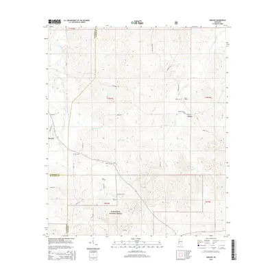
2015 Map of Barlow
USGS Topo · Published 2015About this map
The Homochitto National Forest anchors the southern portion of this landscape where the borders of Copiah, Claiborne, and Jefferson Counties converge. This 2015 survey reveals a rural network defined by family-named cemeteries and quiet settlements. The community of Barlow sits at the intersection of Barlow Rd and Salem Rd, serving as a central point for local residents near the Rehobeth-Barlow Cem. To the west, the settlement of Burnell is positioned along Owens Park Rd near the waters of Brandywine Cr and Brandywine Spring.
Find a feature on this map
41 named features on this map. Tap any name to fly to it.
Don’t see what you’re looking for? This feature index may not catch every label — zoom into the map to look around manually.
Map Details
Editions of this 2015 Barlow Map
This is the sole edition of this map. No revisions or reprints were ever made.
Other maps of this area

1953 · Natchez
USGS Topo · 1:250,000

1956 · Natchez
USGS Topo · 1:250,000

1959 · Natchez
USGS Topo · 1:250,000

1963 · Dentville NW
USGS Topo · 1:24,000

1963 · Dentville
USGS Topo · 1:24,000

1963 · Smyrna
USGS Topo · 1:24,000

1963 · Union Church
USGS Topo · 1:62,500
1963 · Hermanville
USGS Topo · 1:24,000

1963 · McBride
USGS Topo · 1:24,000

1963 · Barlow
USGS Topo · 1:24,000