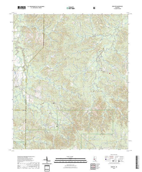
2024 Map of Barlow
USGS Topo · Published 2024About this map
Little Bayou Pierre and its numerous tributaries, including Foster Creek and Brandywine Creek, define the rolling wooded landscape of this southern Mississippi terrain. The area is characterized by a high density of family and community burial grounds, such as Hartley Cem, Segrest Cem, and Weeks Cem, which serve as vital markers for local genealogical research. In the northern reaches of the Homochitto National Forest, the small settlements of Barlow and Burnell anchor a network of rural roads like Warren Hood Rd and Barlow Rd. The map illustrates the convergence of Copiah, Claiborne, and Jefferson counties, providing a contemporary view of the land's ongoing transition from traditional timber use to managed forest preservation. Notable landmarks like the Dixon Airport and Brandywine Spring highlight the dispersed nature of local industry and natural resources in this quiet corner of the state.
Find a feature on this map
44 named features on this map. Tap any name to fly to it.
Don’t see what you’re looking for? This feature index may not catch every label — zoom into the map to look around manually.
Map Details
Editions of this 2024 Barlow Map
This is the sole edition of this map. No revisions or reprints were ever made.
Other maps of this area

1953 · Natchez
USGS Topo · 1:250,000

1956 · Natchez
USGS Topo · 1:250,000

1959 · Natchez
USGS Topo · 1:250,000

1963 · Dentville NW
USGS Topo · 1:24,000

1963 · Dentville
USGS Topo · 1:24,000

1963 · Smyrna
USGS Topo · 1:24,000

1963 · Union Church
USGS Topo · 1:62,500
1963 · Hermanville
USGS Topo · 1:24,000

1963 · McBride
USGS Topo · 1:24,000

1963 · Barlow
USGS Topo · 1:24,000