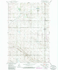
1950 Map of Barlow
USGS Topo · Published 1986About this map
Barlow stands as a central settlement in Foster County, positioned along the Burlington Northern railroad line in this mid-century landscape. The topography is characterized by a complex network of wetlands and drainage patterns, including Rosefield Slough, Scotts Slough, and Lake Claire, which feed into Rocky Run. A designated National Waterfowl Production Area occupies a significant portion of the eastern landscape, highlighting the region's importance to conservation and wildlife.
Find a feature on this map
15 named features on this map. Tap any name to fly to it.
Don’t see what you’re looking for? This feature index may not catch every label — zoom into the map to look around manually.
Map Details
Editions of this 1950 Barlow Map
2 editions found
Other maps of this area

1948 · New Rockford
USGS Topo · 1:62,500

1948 · Cathay
USGS Topo · 1:62,500

1948 · Carrington
USGS Topo · 1:62,500

1949 · Cathay SE
USGS Topo · 1:24,000

1949 · Munster
USGS Topo · 1:24,000

1950 · Carrington East
USGS Topo · 1:24,000

1950 · New Rockford
USGS Topo · 1:24,000

1950 · New Rockford NE
USGS Topo · 1:24,000
1950 · New Rockford SE
USGS Topo · 1:24,000

1950 · Barlow
USGS Topo · 1:24,000