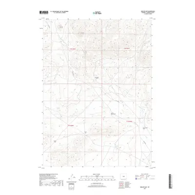
2017 Map of Barlow Gap
USGS Topo · Published 2017About this map
Barlow Gap and Crilly Gap form the primary topographic breaks in this high-elevation segment of Natrona County. The landscape is defined by its intermittent water sources and high peaks, most notably Bald Mtn and Goat Mtn in the north. The drainage patterns are clearly etched into the terrain, characterized by features like Barlow Springs Draw and Greasewood Draw, which funnel seasonal runoff toward the ephemeral Dry Cr.
Find a feature on this map
15 named features on this map. Tap any name to fly to it.
Don’t see what you’re looking for? This feature index may not catch every label — zoom into the map to look around manually.
Map Details
Editions of this 2017 Barlow Gap Map
This is the sole edition of this map. No revisions or reprints were ever made.
Other maps of this area

1951 · Lone Mountain
USGS Topo · 1:24,000

1952 · Ervay Basin SW
USGS Topo · 1:24,000

1955 · Casper
USGS Topo · 1:250,000

1958 · Casper
USGS Topo · 1:250,000
1959 · Stinking Water Creek
USGS Topo · 1:24,000

1959 · Saddle Rock
USGS Topo · 1:24,000

1959 · Miller Spring
USGS Topo · 1:24,000

1959 · Blackjack Ranch
USGS Topo · 1:24,000

1959 · Barlow Gap
USGS Topo · 1:24,000
1959 · Garfield Peak
USGS Topo · 1:24,000