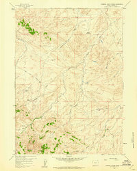
1959 Map of Stinking Water Creek
USGS Topo · Published 1961About this map
The high-desert terrain of the Rattlesnake Range dominates this late-1950s landscape, where drainage patterns define the limits of ranching and exploration. The isolated Neil Bell Monument stands as a lonely landmark near the Middle Fork Casper Creek, overlooking a network of seasonal draws and creeks. Ranching life is anchored by family operations such as the Forgey Ranch and Sun Ranch, while the presence of an Oil Well and the Oil City Ranch points to the early petroleum interests in Natrona County. The drainage of Stinking Water Creek and Poison Spider Creek creates a rugged geography of basins and canyons, including the steep Eagles Nest Canyon and the high-altitude Snider Basin. This survey documents a transition in Wyoming's backcountry where traditional livestock ranges began to share space with energy prospecting along the primitive Poison Spider Road.
Find a feature on this map
20 named features on this map. Tap any name to fly to it.
Don’t see what you’re looking for? This feature index may not catch every label — zoom into the map to look around manually.
Map Details
Editions of this 1959 Stinking Water Creek Map
2 editions found
Other maps of this area

1955 · Casper
USGS Topo · 1:250,000

1958 · Casper
USGS Topo · 1:250,000

1959 · Gaylord Reservoir
USGS Topo · 1:24,000

1959 · Eightmile Draw
USGS Topo · 1:24,000

1959 · Broad Mesa
USGS Topo · 1:24,000
1959 · Mc Rae Gap
USGS Topo · 1:24,000

1959 · Horse Creek Springs
USGS Topo · 1:24,000

1959 · Saddle Rock
USGS Topo · 1:24,000

1959 · Barlow Gap
USGS Topo · 1:24,000
1959 · Garfield Peak
USGS Topo · 1:24,000