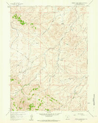
1959 Map of Stinking Water Creek
USGS Topo · Published 1964About this map
Sun Ranch and other remote outposts anchor this mid-century survey of the high plains and drainage systems north of the Rattlesnake Range. The landscape is defined by the complex network of seasonal watercourses and draws that feed into Stinking Water Creek and the Middle Fork Casper Creek. Evidence of early energy exploration is scattered across the terrain, with several Oil Wells and the Oil City Ranch suggesting a shift from traditional cattle ranching toward industrial resource extraction in the late 1950s.
Find a feature on this map
20 named features on this map. Tap any name to fly to it.
Don’t see what you’re looking for? This feature index may not catch every label — zoom into the map to look around manually.
Map Details
Editions of this 1959 Stinking Water Creek Map
2 editions found
Other maps of this area

1955 · Casper
USGS Topo · 1:250,000

1958 · Casper
USGS Topo · 1:250,000

1959 · Gaylord Reservoir
USGS Topo · 1:24,000

1959 · Eightmile Draw
USGS Topo · 1:24,000

1959 · Broad Mesa
USGS Topo · 1:24,000
1959 · Mc Rae Gap
USGS Topo · 1:24,000

1959 · Horse Creek Springs
USGS Topo · 1:24,000
1959 · Stinking Water Creek
USGS Topo · 1:24,000

1959 · Saddle Rock
USGS Topo · 1:24,000

1959 · Barlow Gap
USGS Topo · 1:24,000